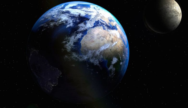
Mostrar mensagens com a etiqueta Alterações climáticas. Mostrar todas as mensagens

quinta-feira, fevereiro 15, 2024

Alguns acham que está a dar o amoque à AMOC...!

Corrente fundamental do Oceano Atlântico está em colapso iminente


Uma nova pesquisa confirma os receios sobre um provável colapso da Circulação Meridional do Atlântico, que é fundamental para vários ecossistemas e para a cadeia alimentar global.

Um estudo publicado em julho do ano passado lançou o alerta: a Circulação Meridional do Atlântico (AMOC), um sistema crucial que regula o clima do Hemisfério Norte, pode entrar em colapso a qualquer momento a partir de 2025, lançando a Terra num caos climático.

Os resultados do estudo sugeriam que o colapso da AMOC originaria uma dramática queda nas temperaturas, o colapso dos ecossistemas oceânicos e o aumento global das tempestades.

Um novo estudo, publicado a semana passada na revista Science Advances traz agora preocupações agravadas sobre o potencial colapso desta corrente oceânica, uma das principais na Terra.

A pesquisa, liderada pelo oceanógrafo René van Westen da Universidade de Utrecht, introduz um sistema de alerta precoce baseado em observações físicas relacionadas ao transporte de salinidade na fronteira sul do Oceano Atlântico.

A AMOC desempenha um papel crucial no clima da Terra, transferindo água salgada e quente do sul para o norte.

Este processo é vital para manter o equilíbrio climático, mas a adição de água doce de glaciares derretidos e o aumento da precipitação estão a diminuir a salinidade da água, comprometendo este ciclo e ameaçando enfraquecer significativamente a AMOC.

Segundo os autores, uma vez atingido um determinado limiar de salinidade, o ponto de inflexão da AMOC poderá ocorrer num período de uma a quatro décadas, implicando mudanças climáticas drásticas e irreversíveis em escalas de tempo humanas, afetando severamente as sociedades ao redor do globo com alterações na temperatura, nível do mar e padrões de precipitação.

O sistema de monitorização direto da AMOC só foi implementado em 2004, o que limita a compreensão completa da sua trajetória de desaceleração. Por isso, os cientistas têm utilizado indicadores indiretos, como os níveis de salinidade, para preencher as lacunas de conhecimento, explica o Science Alert.

O estudo sugere que a AMOC é mais sensível às mudanças do que os modelos climáticos atuais preveem, confirmando preocupações anteriores de que os modelos climáticos superestimam sistematicamente a estabilidade da AMOC.

O possível colapso da AMOC traria extensas alterações climáticas, afetando ecossistemas inteiros e a segurança alimentar global.

Com a previsão de temperaturas mais baixas no noroeste da Europa, alterações nas monções tropicais e aquecimento adicional no Hemisfério Sul, o estudo adiciona urgência à preocupação crescente sobre um colapso iminente da AMOC.


in ZAP

quarta-feira, fevereiro 14, 2024

Notícia sobre evolução e alterações climáticas à escala do tempo geológico...

A Terra teve duas eras climáticas distintas nos últimos 66 milhões de anos. Já sabemos porquê


vales secos antártida


O impacto do meteorito Chicxulub e a glaciação do Hemisfério Sul foram dois importantes pontos de viragem no clima da Terra.

Uma nova investigação publicada na revista Scientific Reports revela detalhes sobre dois eventos climáticos significativos que moldaram o clima da Terra nos últimos 66 milhões de anos.

A pesquisa foi influenciada pela teoria do equilíbrio pontuado, que sugere que as espécies evoluem em surtos curtos e não gradualmente ao longo do tempo. Esta teoria foi adaptada para avaliar o impacto histórico das alterações climáticas, utilizando métodos estatísticos avançados para analisar duas séries de dados climáticos, explica o SciTech Daily.

Os resultados revelam dois eventos cruciais que dominaram a evolução climática da Terra. O primeiro é o impacto do meteorito Chicxulub no México, que levou à extinção de grandes dinossauros há cerca de 65,5 milhões de anos. Este evento marcou o início de um período quente com níveis elevados de CO2.

O segundo evento foi um ponto de viragem climático que ocorreu há 34 milhões de anos com a glaciação do Hemisfério Sul. O isolamento do continente antártico devido aos movimentos das placas tectónicas marcou uma nova era de um clima mais frio na Terra, que continua a influenciar o nosso sistema climático atual.

Este regime climático ainda está em vigor hoje, com a presença de grandes massas de gelo a desempenhar um papel crítico na manutenção do clima global. O estudo adverte que, se estas massas de gelo derreterem devido ao aquecimento global causado pelas atividades humanos, isso representaria outro ponto de viragem crucial, levando a uma nova e imprevisível paisagem climática.

Denis-Didier Rousseau, autor principal do estudo, alerta que as massas de gelo são “muito sensíveis” e já mostram sinais de derretimento. “Ultrapassar pontos de viragem tem sido uma característica recorrente na evolução climática,” acrescenta Valerio Lucarini, sublinhando a necessidade das estratégias de adaptação climática considerarem a desestabilização destes elementos climáticos críticos.

Como o estudo faz parte do projeto europeu TiPES, focado em pontos de viragem no Sistema Terrestre, os resultados contribuem para o nosso entendimento de como o clima da Terra poderá evoluir face ao impacto humano.


in ZAP

quinta-feira, junho 15, 2023

A erupção do Pinatubo, que afetou significativamente o clima da Terra, começou há 32 anos

The eruption column of Mount Pinatubo on June 12, 1991, three days before the climactic eruption
      
Mount Pinatubo is an active stratovolcano located on the island of Luzon, near the tripoint of the Philippine provinces of Zambales, Tarlac, and Pampanga. It is located in the Cabusilan Mountains separating the west coast of Luzon from the central plains. Before the volcanic activities of 1991, its eruptive history was unknown to most people. It was heavily eroded, inconspicuous and obscured from view. It was covered with dense forest which supported a population of several thousand indigenous people, the Aetas, who fled to the mountains during the Spanish conquest of the Philippines.
The volcano's Plinian/Ultra-Plinian eruption on June 15, 1991, produced the second largest terrestrial eruption of the 20th century after the 1912 eruption of Novarupta in the Alaska Peninsula. Complicating the eruption was the arrival of Typhoon Yunya bringing a lethal mix of ash and rain. Successful predictions at the onset of the climactic eruption led to the evacuation of tens of thousands of people from the surrounding areas, saving many lives, but the surrounding areas were severely damaged by pyroclastic flows, ash deposits, and subsequently, by the lahars caused by rainwaters re-mobilizing earlier volcanic deposits causing extensive destruction to infrastructure and altering the river systems months to years after the eruption.
The effects of the eruption were felt worldwide. It ejected roughly 10,000,000,000 tonnes  or 10 km3 of magma, and 20,000,000 tonnes of SO2, bringing vast quantities of minerals and metals to the surface environment. It injected large amounts of particulate into the stratosphere – more than any eruption since that of Krakatoa in 1883. Over the following months, the aerosols formed a global layer of sulfuric acid haze. Global temperatures dropped by about 0.5 °C and ozone depletion temporarily increased substantially.
    

quarta-feira, junho 15, 2022

A erupção do Pinatubo, que afetou significativamente o clima da Terra, começou há 31 anos

The eruption column of Mount Pinatubo on June 12, 1991, three days before the climactic eruption
    
Mount Pinatubo is an active stratovolcano located on the island of Luzon, near the tripoint of the Philippine provinces of Zambales, Tarlac, and Pampanga. It is located in the Cabusilan Mountains separating the west coast of Luzon from the central plains. Before the volcanic activities of 1991, its eruptive history was unknown to most people. It was heavily eroded, inconspicuous and obscured from view. It was covered with dense forest which supported a population of several thousand indigenous people, the Aetas, who fled to the mountains during the Spanish conquest of the Philippines.
The volcano's Plinian/Ultra-Plinian eruption on June 15, 1991, produced the second largest terrestrial eruption of the 20th century after the 1912 eruption of Novarupta in the Alaska Peninsula. Complicating the eruption was the arrival of Typhoon Yunya bringing a lethal mix of ash and rain. Successful predictions at the onset of the climactic eruption led to the evacuation of tens of thousands of people from the surrounding areas, saving many lives, but the surrounding areas were severely damaged by pyroclastic flows, ash deposits, and subsequently, by the lahars caused by rainwaters re-mobilizing earlier volcanic deposits causing extensive destruction to infrastructure and altering the river systems months to years after the eruption.
The effects of the eruption were felt worldwide. It ejected roughly 10,000,000,000 tonnes  or 10 km3 of magma, and 20,000,000 tonnes of SO2, bringing vast quantities of minerals and metals to the surface environment. It injected large amounts of particulate into the stratosphere – more than any eruption since that of Krakatoa in 1883. Over the following months, the aerosols formed a global layer of sulfuric acid haze. Global temperatures dropped by about 0.5 °C and ozone depletion temporarily increased substantially.
    

terça-feira, junho 15, 2021

Uma erupção do Pinatubo afetou significativamente o clima em toda a Terra há trinta anos

The eruption column of Mount Pinatubo on June 12, 1991, three days before the climactic eruption
    
Mount Pinatubo is an active stratovolcano located on the island of Luzon, near the tripoint of the Philippine provinces of Zambales, Tarlac, and Pampanga. It is located in the Cabusilan Mountains separating the west coast of Luzon from the central plains. Before the volcanic activities of 1991, its eruptive history was unknown to most people. It was heavily eroded, inconspicuous and obscured from view. It was covered with dense forest which supported a population of several thousand indigenous people, the Aetas, who fled to the mountains during the Spanish conquest of the Philippines.
The volcano's Plinian/Ultra-Plinian eruption on June 15, 1991, produced the second largest terrestrial eruption of the 20th century after the 1912 eruption of Novarupta in the Alaska Peninsula. Complicating the eruption was the arrival of Typhoon Yunya bringing a lethal mix of ash and rain. Successful predictions at the onset of the climactic eruption led to the evacuation of tens of thousands of people from the surrounding areas, saving many lives, but the surrounding areas were severely damaged by pyroclastic flows, ash deposits, and subsequently, by the lahars caused by rainwaters re-mobilizing earlier volcanic deposits causing extensive destruction to infrastructure and altering the river systems months to years after the eruption.
The effects of the eruption were felt worldwide. It ejected roughly 10,000,000,000 tonnes  or 10 km3 of magma, and 20,000,000 tonnes of SO2, bringing vast quantities of minerals and metals to the surface environment. It injected large amounts of particulate into the stratosphere – more than any eruption since that of Krakatoa in 1883. Over the following months, the aerosols formed a global layer of sulfuric acid haze. Global temperatures dropped by about 0.5 °C and ozone depletion temporarily increased substantially.
    

segunda-feira, junho 15, 2020

Começou há 29 anos uma erupção que afetou significativamente o clima em toda a Terra

The eruption column of Mount Pinatubo on June 12, 1991, three days before the climactic eruption
    
Mount Pinatubo is an active stratovolcano located on the island of Luzon, near the tripoint of the Philippine provinces of Zambales, Tarlac, and Pampanga. It is located in the Cabusilan Mountains separating the west coast of Luzon from the central plains. Before the volcanic activities of 1991, its eruptive history was unknown to most people. It was heavily eroded, inconspicuous and obscured from view. It was covered with dense forest which supported a population of several thousand indigenous people, the Aetas, who fled to the mountains during the Spanish conquest of the Philippines.
The volcano's Plinian/Ultra-Plinian eruption on June 15, 1991, produced the second largest terrestrial eruption of the 20th century after the 1912 eruption of Novarupta in the Alaska Peninsula. Complicating the eruption was the arrival of Typhoon Yunya bringing a lethal mix of ash and rain. Successful predictions at the onset of the climactic eruption led to the evacuation of tens of thousands of people from the surrounding areas, saving many lives, but the surrounding areas were severely damaged by pyroclastic flows, ash deposits, and subsequently, by the lahars caused by rainwaters re-mobilizing earlier volcanic deposits causing extensive destruction to infrastructure and altering the river systems months to years after the eruption.
The effects of the eruption were felt worldwide. It ejected roughly 10,000,000,000 tonnes  or 10 km3 of magma, and 20,000,000 tonnes of SO2, bringing vast quantities of minerals and metals to the surface environment. It injected large amounts of particulate into the stratosphere – more than any eruption since that of Krakatoa in 1883. Over the following months, the aerosols formed a global layer of sulfuric acid haze. Global temperatures dropped by about 0.5 °C and ozone depletion temporarily increased substantially.
    

sábado, junho 15, 2019

O Pinatubo, vulcão das Flipinas, teve há 28 anos uma erupção que afetou o clima terrestre

The eruption column of Mount Pinatubo on June 12, 1991, three days before the climactic eruption
Mount Pinatubo is an active stratovolcano located on the island of Luzon, near the tripoint of the Philippine provinces of Zambales, Tarlac, and Pampanga. It is located in the Cabusilan Mountains separating the west coast of Luzon from the central plains. Before the volcanic activities of 1991, its eruptive history was unknown to most people. It was heavily eroded, inconspicuous and obscured from view. It was covered with dense forest which supported a population of several thousand indigenous people, the Aetas, who fled to the mountains during the Spanish conquest of the Philippines.
The volcano's Plinian/Ultra-Plinian eruption on June 15, 1991, produced the second largest terrestrial eruption of the 20th century after the 1912 eruption of Novarupta in the Alaska Peninsula. Complicating the eruption was the arrival of Typhoon Yunya bringing a lethal mix of ash and rain. Successful predictions at the onset of the climactic eruption led to the evacuation of tens of thousands of people from the surrounding areas, saving many lives, but the surrounding areas were severely damaged by pyroclastic flows, ash deposits, and subsequently, by the lahars caused by rainwaters re-mobilizing earlier volcanic deposits causing extensive destruction to infrastructure and altering the river systems months to years after the eruption.
The effects of the eruption were felt worldwide. It ejected roughly 10,000,000,000 tonnes (1.1×10¹⁰short tons) or 10 km3 of magma, and 20,000,000 tonnes (22,000,000 short tons) of SO
2, bringing vast quantities of minerals and metals to the surface environment. It injected large amounts of particulate into the stratosphere – more than any eruption since that of Krakatoa in 1883. Over the following months, the aerosols formed a global layer of sulfuric acid haze. Global temperatures dropped by about 0.5 °C and ozone depletion temporarily increased substantially.
  

quarta-feira, fevereiro 20, 2019

Há nove anos, a Meteorologia e erros humanos levaram a uma catástrofe na Madeira

Ribeira de Santa Luzia transbordando para a Rua cinco de outubro
Danos: 217 milhões de euros
Vítimas: 47 mortos, 600 desalojados e 250 feridos
O temporal na ilha da Madeira em 2010 foi uma sequência de acontecimentos iniciados por forte precipitação durante a madrugada do dia 20 de fevereiro, seguida por uma subida do nível do mar. Estes acontecimentos provocaram inundações e derrocadas ao longo das encostas da ilha, em especial na parte sul.

Ribeira de Santa Luzia, antes das cheias - o sedimento depositado atingiu a altura do caminho público, após as inundações

Causas
Na origem do fenómeno esteve um sistema frontal de forte atividade, associado a uma depressão que se deslocou a partir dos Açores, segundo o Instituto de Meteorologia. O choque da massa de ar polar com a tropical deu origem a uma superfície frontal, que, aliada à elevada temperatura da água do oceano, acelerou a condensação, causando uma precipitação extremamente elevada num curto espaço de tempo. A orografia da ilha contribuiu para aumentar os efeitos da catástrofe. É claro que, aliado a valores de precipitação recorde, erros de planeamento urbanístico, tais como o estreitamento de leitos das ribeiras e a construção legal ou ilegal dentro ou muito próximo dos cursos de água, bem como falta de limpeza e acumulação de lixo nos leitos de ribeiras de menor dimensão, tenham tornado a situação ainda mais grave.
  
Efeitos
A parte baixa da cidade do Funchal foi inundada e a circulação viária foi impedida por pedras e troncos de árvore arrastados pelas ribeiras de São João, Santa Luzia e João Gomes. Na freguesia do Monte, a capela de Nossa Senhora da Conceição, ao Largo das Babosas, foi levada pela força das águas, junto com algumas das residências vizinhas. Alguns populares conseguiram salvar a imagem da virgem e vários ornamentos.
Foram confirmados 47 mortos, 600 desalojados e 250 feridos. O Curral das Freiras esteve acessível, embora com acesso condicionado. A freguesia da Serra de Água, a montante da Ribeira Brava, esteve completamente inacessível. Eram evidentes os sinais de destruição provocados pelas enxurradas, com as zonas altas do concelho do Funchal e, também, no concelho da Ribeira Brava a serem as mais afetadas.
A quantidade de água que caiu no dia 20 de fevereiro de 2010 sobre a ilha da Madeira, em particular no Pico do Areeiro, foi o maior valor jamais registado em Portugal. Neste cume, o segundo mais alto da ilha, foram registados 185 litros por metro quadrado, sendo que os valores mais altos registados em Portugal, que até aquela altura não chegavam aos 120. O Funchal, com uma média anual de 750 l/m² registou, em poucas horas, 114 l/m² de precipitação.
   

domingo, junho 15, 2014

O Pinatubo, vulcão das Flipinas, teve há 23 anos uma erupção que afetou o clima do mundo inteiro

The eruption column of Mount Pinatubo on June 12, 1991, three days before the climactic eruption

Mount Pinatubo is an active stratovolcano located on the island of Luzon, near the tripoint of the Philippine provinces of Zambales, Tarlac, and Pampanga. It is located in the Cabusilan Mountains separating the west coast of Luzon from the central plains. Before the volcanic activities of 1991, its eruptive history was unknown to most people. It was heavily eroded, inconspicuous and obscured from view. It was covered with dense forest which supported a population of several thousand indigenous people, the Aetas, who fled to the mountains during the Spanish conquest of the Philippines.
The volcano's Plinian/Ultra-Plinian eruption on June 15, 1991, produced the second largest terrestrial eruption of the 20th century after the 1912 eruption of Novarupta in the Alaska Peninsula. Complicating the eruption was the arrival of Typhoon Yunya bringing a lethal mix of ash and rain. Successful predictions at the onset of the climactic eruption led to the evacuation of tens of thousands of people from the surrounding areas, saving many lives, but the surrounding areas were severely damaged by pyroclastic flows, ash deposits, and subsequently, by the lahars caused by rainwaters re-mobilizing earlier volcanic deposits causing extensive destruction to infrastructure and altering the river systems months to years after the eruption.
The effects of the eruption were felt worldwide. It ejected roughly 10,000,000,000 tonnes (1.1×10¹⁰short tons) or 10 km3 of magma, and 20,000,000 tonnes (22,000,000 short tons) of SO
2, bringing vast quantities of minerals and metals to the surface environment. It injected large amounts of particulate into the stratosphere – more than any eruption since that of Krakatoa in 1883. Over the following months, the aerosols formed a global layer of sulfuric acid haze. Global temperatures dropped by about 0.5 °C and ozone depletion temporarily increased substantially.

quinta-feira, fevereiro 20, 2014

Há quatro anos, a Meteorologia e os erros humanos levaram a uma grande catástrofe na Madeira

Ribeira de Santa Luzia transbordando para a Rua 5 de outubro

Danos: 217 milhões de euros
Vítimas: 47 mortos, 600 desalojados e 250 feridos

O temporal na ilha da Madeira em 2010 foi uma sequência de acontecimentos iniciados por forte precipitação durante a madrugada do dia 20 de fevereiro, seguida por uma subida do nível do mar. Estes acontecimentos provocaram inundações e derrocadas ao longo das encostas da ilha, em especial na parte sul.

Ribeira de Santa Luzia, antes das cheias - o sedimento depositado atingiu a altura do caminho público, após as inundações

Causas
Na origem do fenómeno esteve um sistema frontal de forte atividade, associado a uma depressão que se deslocou a partir dos Açores, segundo o Instituto de Meteorologia. O choque da massa de ar polar com a tropical deu origem a uma superfície frontal, que, aliada à elevada temperatura da água do oceano, acelerou a condensação, causando uma precipitação extremamente elevada num curto espaço de tempo. A orografia da ilha contribuiu para aumentar os efeitos da catástrofe. É claro que, aliado a valores de precipitação recorde, erros de planeamento urbanístico, tais como o estreitamento de leitos das ribeiras e a construção legal ou ilegal dentro ou muito próximo dos cursos de água, bem como falta de limpeza e acumulação de lixo nos leitos de ribeiras de menor dimensão, tenham tornado a situação ainda mais grave.

Efeitos
A parte baixa da cidade do Funchal foi inundada e a circulação viária foi impedida por pedras e troncos de árvore arrastados pelas ribeiras de São João, Santa Luzia e João Gomes. Na freguesia do Monte, a capela de Nossa Senhora da Conceição, ao Largo das Babosas, foi levada pela força das águas, junto com algumas das residências vizinhas. Alguns populares conseguiram salvar a imagem da virgem e vários ornamentos.
Foram confirmados 47 mortos, 600 desalojados e 250 feridos. O Curral das Freiras esteve acessível, embora com acesso condicionado. A freguesia da Serra de Água, a montante da Ribeira Brava, esteve completamente inacessível. Eram evidentes os sinais de destruição provocados pelas enxurradas, com as zonas altas do concelho do Funchal e, também, no concelho da Ribeira Brava a serem as mais afetadas.
A quantidade de água que caiu no dia 20 de fevereiro de 2010 sobre a ilha da Madeira, em particular no Pico do Areeiro, foi o valor mais alto jamais registado em Portugal. Neste cume, o segundo mais alto da ilha, foram registados 185 litros por metro quadrado, sendo que os valores mais altos registados em Portugal, que até aquela altura não chegavam aos 120. O Funchal, com uma média anual de 750 l/m² registou, em poucas horas, 114 l/m² de precipitação.

sábado, maio 08, 2010

Colóquio sobre Alterações Climáticas na Marinha Grande


A OikosAssociação de Defesa do Ambiente e do Património da Região de Leiria, vai realizar, no dia 27 de Maio de 2010 (quinta-feira), às 21.00 horas, na Biblioteca Municipal da Marinha Grande, um colóquio subordinado ao tema "Alterações Climáticas".

Divulga o evento e comparece...