Porque conseguimos prever eclipses ao segundo - mas não os terramotos

Da rede de telemóveis Android que alertou utilizadores na Venezuela aos sistemas públicos do México e do Japão, a tecnologia não é capaz de prever terramotos: apenas tenta comprar-nos alguns segundos depois de o sismo começar — e transformar esses segundos em proteção.
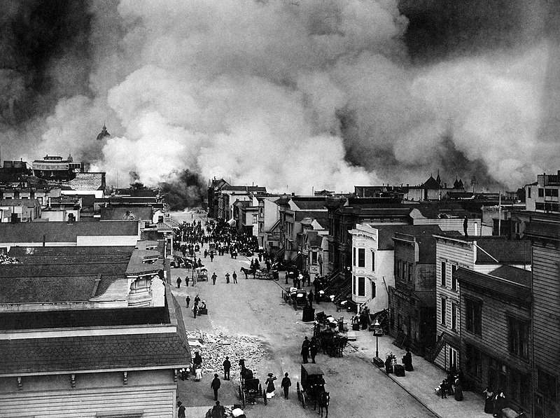
Os dois sismos que atingiram o norte da Venezuela a 24 de junho voltaram a expor uma frustração antiga: a ciência calcula eclipses com séculos de antecedência e antecipa furacões com dias, mas continua incapaz de dizer quando a Terra vai tremer.
A explicação dos sismólogos é direta - é possível saber onde e com que frequência ocorrem grandes terramotos, mas não o dia nem a hora. E essa limitação não nasce de falta de tecnologia: está na própria natureza do fenómeno.
Ainda assim, segundo o El País, alguns segundos antes de o abalo ser sentido em várias zonas, milhões de utilizadores Android receberam um aviso no telemóvel. Não foi uma previsão - foi deteção em tempo real.
Num país sem qualquer sistema oficial de alerta sísmico precoce, foi um sistema da Google, assente nos sensores de milhões de telemóveis Android, que deu a algumas pessoas os poucos segundos que em alguns casos fizeram a diferença.
Para perceber a aparente contradição, é preciso separar três coisas que se confundem com frequência:
- Uma é prever: dizer quando, onde e com que magnitude vai ocorrer um sismo, dentro de margens úteis — algo que hoje não se consegue fazer.
- Outra é estimar o risco: calcular a probabilidade de um grande abalo numa região ao longo de décadas — isso faz-se, e é o que sustenta os códigos de construção antissísmica.
- A terceira é alertar: detetar um sismo que já começou e avisar antes da chegada das ondas mais destrutivas — e isso funciona.
A previsão é o elo impossível. A rutura que origina um grande sismo ocorre a vários quilómetros de profundidade, longe de qualquer instrumento que a meça diretamente, e comporta-se como um sistema caótico: uma pequena fratura tanto pode travar como propagar-se e desencadear um abalo devastador — e não há maneira de saber, à partida, qual dos dois caminhos vai seguir.
Ao longo das últimas décadas, foram sendo testados supostos sinais precursores — como emanações de radão no solo, alterações em águas subterrâneas, comportamento anómalo dos animais, perturbações eletromagnéticas, as chamadas “luzes de terramoto“. Nenhum se mostrou fiável e repetível.
Quanto aos abalos premonitórios, só se identificam como tal depois do grande sismo: a esmagadora maioria dos pequenos tremores não é seguida de nada.
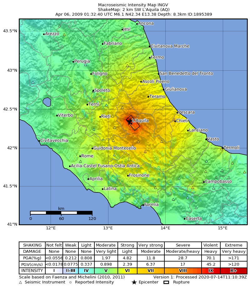
A confusão entre previsão e comunicação de risco já teve consequências graves. Três anos depois do sismo de L’Aquila, em 2009, que matou mais de 300 pessoas, sete membros da Comissão Italiana de Grandes Riscos (seis cientistas e um responsável da Proteção Civil) foram condenados por homicídio involuntário.
Ao contrário do que muitas vezes se repetiu, estes peritos não foram julgados por não terem previsto o terramoto, mas pela forma como comunicaram o risco à população, depois de uma série de pequenos abalos ter sido descrita como não representando perigo iminente.
As condenações dos seis cientistas acabariam por ser anuladas em recurso e a absolvição foi confirmada pelo supremo tribunal italiano. Restou apenas a condenação, parcial, de Bernardo de Bernardinis, o responsável da Proteção Civil — mas o caso serviu de aviso para os perigos de transmitir falsas certezas.
Se não se pode prever, pode detetar-se
Os sistemas de alerta precoce tiram partido de uma corrida desigual entre os diferentes tipos de ondas sísmicas.
Quando um sismo começa, liberta primeiro as ondas P, rápidas (cerca de seis km/s) mas pouco destrutivas, e só depois as ondas S e de superfície, mais lentas (3 a 4 km/s) e responsáveis pela maior parte dos estragos.
Como os dados digitais viajam muito mais depressa do que qualquer onda sísmica, um sensor próximo do epicentro pode detetar as ondas P e disparar um alerta que chega às zonas mais distantes antes de o impacto mais forte do abalo se fazer sentir, explica o USGS.
São alguns segundos de avanço, por vezes dezenas de segundos — o suficiente para parar comboios, imobilizar elevadores ou procurar abrigo.
O México foi pioneiro nos sistemas públicos de alerta sísmico precoce: o seu sistema SASMEX funciona desde o início dos anos 1990 e pode dar à Cidade do México até 60 segundos de aviso, com alertas por sirenes e rádio.
O Japão, com centenas de estações, incluindo sensores no fundo do mar, envia os avisos diretamente para os telemóveis; nos Estados Unidos, o ShakeAlert cobre a costa oeste e chega a parar o metro automaticamente.
Portugal dispõe de vigilância sísmica e informação em tempo quase real através do IPMA, mas não de um sistema público massificado que avise a população segundos antes da chegada do abalo. Para tsunamis, existe um sistema de alerta operado pelo IPMA e integrado no NEAMTWS.
A Venezuela não tinha um sistema oficial de alerta precoce deste tipo. Situado entre as placas das Caraíbas e sul-americana, o país é sismicamente ativo, mas a sua rede nacional de estações de monitorização é limitada, e não dispõe de um sistema oficial de alerta: o organismo de vigilância FUNVISIS monitoriza e informa, mas não emite avisos antecipados.
O que funcionou foi o sistema de alertas da Google para Android, que transforma os acelerómetros de mais de dois mil milhões de telemóveis em minissismógrafos: quando um número suficiente de aparelhos na mesma zona deteta em simultâneo um padrão sísmico, um servidor central confirma o evento e dispara o aviso.
Segundo um estudo publicado na Science em 2025, o sistema já detetou mais de 18 mil sismos desde 2021 e mostrou que os telemóveis podem complementar as redes sísmicas convencionais, sobretudo em regiões sem sistemas oficiais de alerta precoce.
O sistema não é infalível, e foi criticado pelo desempenho insuficiente nos sismos da Turquia e da Síria em 2023, quando subestimou a magnitude e não enviou alertas de nível máximo à maioria dos utilizadores em risco. Mas, na ausência de alternativa, foi o que deu a muitos, em Caracas, alguns segundos para procurar proteção.
Até a ciência aprender a ler a Terra antes de ela se mexer, “prever” um terramoto continua a resumir-se a uma única certeza: a de que vai acontecer.
in ZAP


.jpg/1920px-TERREMOTO_PORTOVIEJO_(26442426462).jpg)