Old map of Port Royal
The 1692 Jamaica earthquake struck Port Royal, Jamaica
on June 7. A stopped pocket watch found in the harbor in 1969 indicated
that it occurred around 11:43 a.m. Port Royal was, at the time, the
unofficial capital of Jamaica, and one of the busiest and wealthiest
ports in the West Indies.
It was known both as the "storehouse and treasury of the West Indies"
and "one of the wickedest places on earth", being a common home port
for the many privateers and pirates operating within the Caribbean Sea.
The earthquake caused most of the city to sink below sea level and
about 2,000 people died as a result of the earthquake and the following
tsunami. About 3,000 people died in the days following the earthquakes
due to injuries and disease.
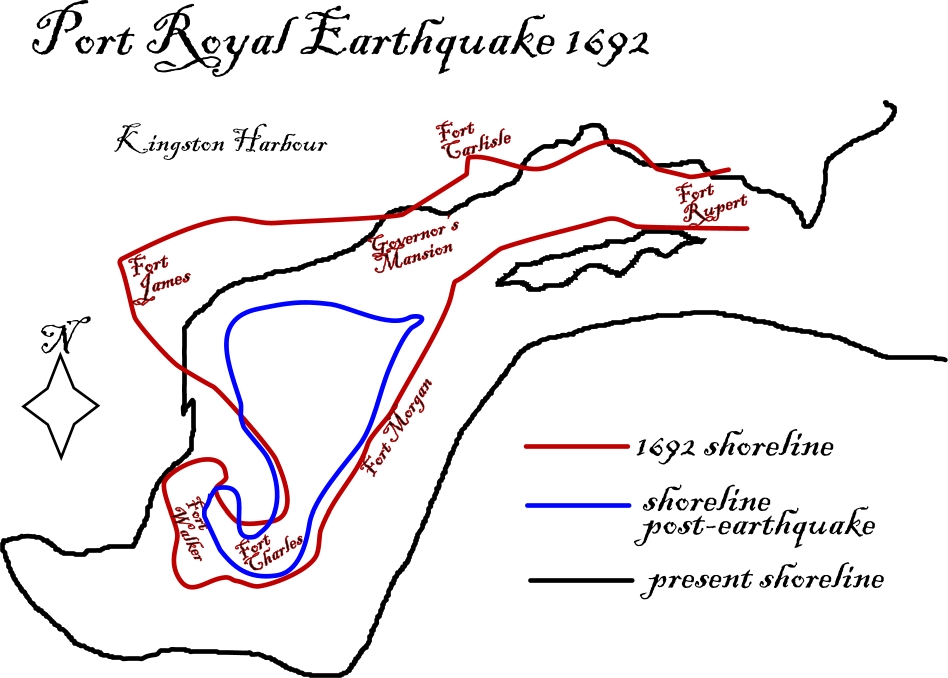
Map of Port Royal showing shorelines before and after the earthquake
The island of Jamaica lies on the boundary between the Caribbean Plate and the Gonâve Microplate. The Gonâve microplate is a 1,100 km (680 mi) long strip of mainly oceanic crust formed by the Cayman spreading ridge within a strike-slip pull-apart basin on the northern transform margin of the Caribbean Plate with the North American Plate. Jamaica was formed by uplift associated with a restraining bend along this strike-slip structure. The focal mechanisms
of earthquakes around Jamaica are primarily sinistral strike-slip
along WSW-ENE trending faults and minor reverse or thrust motion on
NW-SE trending faults. The 1692 event is thought to have occurred on
one of these strike-slip faults.

The Gonâve microplate, showing the main fault zones that bound it
in Wikipédia