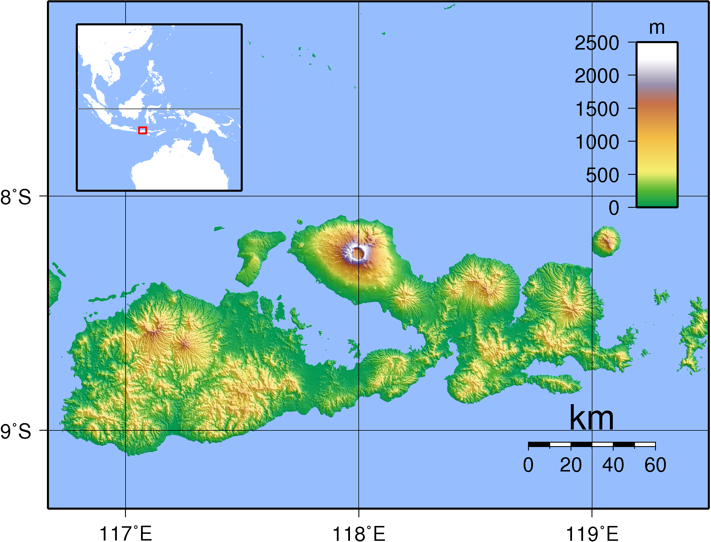
Topographic map of Tambora and Sumbawa
Mount Tambora (or Tamboro) is an active stratovolcano on the island of Sumbawa, Indonesia. Sumbawa is flanked both to the north and south by oceanic crust, and Tambora was formed by the active subduction zone beneath it. This raised Mount Tambora as high as 4.300 m, making it, in the 18th century, one of the tallest peaks in the Indonesian archipelago. After a large magma chamber inside the mountain filled over the course of several decades, volcanic activity reached a historic climax in the eruption of 10 April 1815. This eruption was approximately VEI-7, the only eruption unambiguously confirmed of that size since the Lake Taupo eruption in about AD 180. The Heaven Lake eruption of Baekdu Mountain, circa AD 969, may have also been VEI-7.
With an estimated ejecta volume of 160 km3, Tambora's 1815 outburst was the largest volcanic eruption in recorded history. The explosion was heard on Sumatra island more than 2,000 km (1,200 mi) away. Heavy volcanic ash falls were observed as far away as Borneo, Sulawesi, Java and Maluku
islands. Most deaths from the eruption were from starvation and
disease, as the eruptive fallout ruined agricultural productivity in the
local region. The death toll was at least 71.000 people, of whom
11.000–12.000 were killed directly by the eruption; the often-cited figure of 92.000 people killed is believed to be overestimated.
The eruption caused global climate anomalies that included the phenomenon known as "volcanic winter": 1816 became known as the "Year Without a Summer" because of the effect on North American and European weather. Crops failed and livestock died in much of the Northern Hemisphere, resulting in the worst famine of the 19th century.
During an excavation in 2004, a team of archaeologists discovered cultural remains buried by the 1815 eruption. They were kept intact beneath the 3 m deep pyroclastic deposits. At the site, dubbed the Pompeii of the East, the artifacts were preserved in the positions they had occupied in 1815.
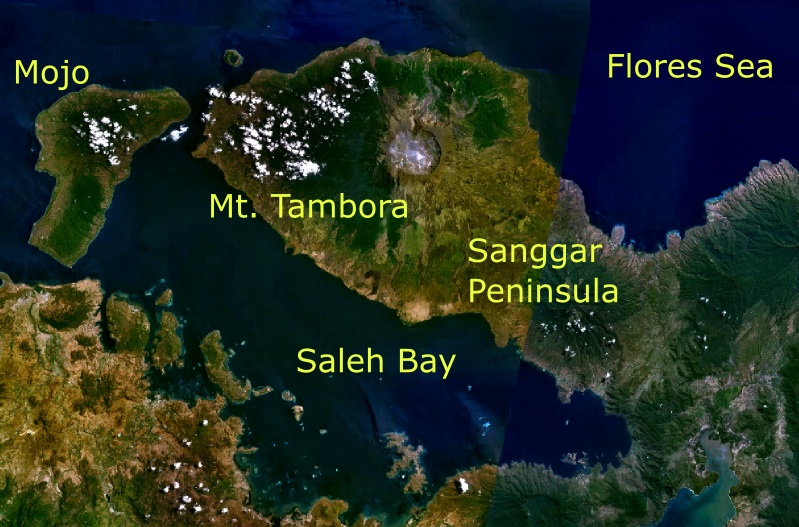
Mt. Tambora and its surroundings as seen from space
The 1815 eruption of Mount Tambora was one of the most powerful in recorded history and classified as a VEI-7 event. Mount Tambora is on the island of Sumbawa in Indonesia. The eruption that began on 10 April 1815 was preceded by between six months and three years of increased steaming and small phreatic eruptions. The eruption column
lowered global temperatures, and some experts believe this led to
global cooling and worldwide harvest failures, sometimes known as the Year Without a Summer.
Chronology of the eruption
Mount Tambora experienced several centuries of inactive dormancy before 1815, as the result of the gradual cooling of hydrous magma in a closed magma chamber. Inside the chamber at depths between 1.5–4.5 km (0.93–2.80 mi), the exsolution of a high-pressure fluid magma formed during cooling and crystallisation of the magma. Overpressure of the chamber of about 4.,000–5.000 bar was generated, and the temperature ranged from 700–850 °C. In 1812, the caldera began to rumble and generated a dark cloud.
On 5 April 1815, a moderate-sized eruption occurred, followed by thunderous detonation sounds, heard in Makassar on Sulawesi, 380 km away, Batavia (now Jakarta) on Java 1.260 km away, and Ternate on the Molucca Islands 1.400 km away. On the morning of 6 April, volcanic ash began to fall in East Java with faint detonation sounds lasting until 10 April. What was first thought to be sound of firing guns was heard on 10 April on Sumatra island more than 2,600 km away.
At about 7 p.m. on 10 April, the eruptions intensified. Three columns of flame rose up and merged. The whole mountain was turned into a flowing mass of "liquid fire". Pumice stones of up to 20 cm in diameter started to rain down at approximately 20.00, followed by ash at around 21.00 – 22.00. Pyroclastic flows
cascaded down the mountain to the sea on all sides of the peninsula,
wiping out the village of Tambora. Loud explosions were heard until the
next evening, 11 April. The ash veil had spread as far as West Java and South Sulawesi. A "nitrous" odour was noticeable in Batavia and heavy tephra-tinged rain fell, finally receding between 11 and 17 April.
The explosion is estimated to have been VEI 7. It had roughly four times the energy of the 1883 Krakatoa eruption, meaning that it was equivalent to an 800 Mt explosion. An estimated 160 km3 of pyroclastic trachyandesite was ejected, weighing approximately 1.414 kg. This has left a caldera measuring 6–7 km across and 600–700 m deep. The density of fallen ash in Makassar
was 636 kg/m². Before the explosion, Mount Tambora was approximately
4,300 m high, one of the tallest peaks in the Indonesian archipelago.
After the explosion, it now measures only 2.851 m.
in Wikipédia